
How Do I Get There: 1840s Travel to Elk County
We are so used to taking a car to where we need to go that we can’t fathom the logistics required to get to someplace as remote as St Mays in the 1840s from the coastal cities of an infant country.

Traveling to a remote area like St Mary’s in the 1840s and 1850s was difficult and slow. Getting there required multiple forms of transportation, including trains, boats, canals, horse and buggy and even by foot. Despite all the settlements advancing into the Midwest by men like Daniel Boone and Lewis and Clark, Elk County remained an untamed wilderness, because the terrain created difficulty for travel at the time.
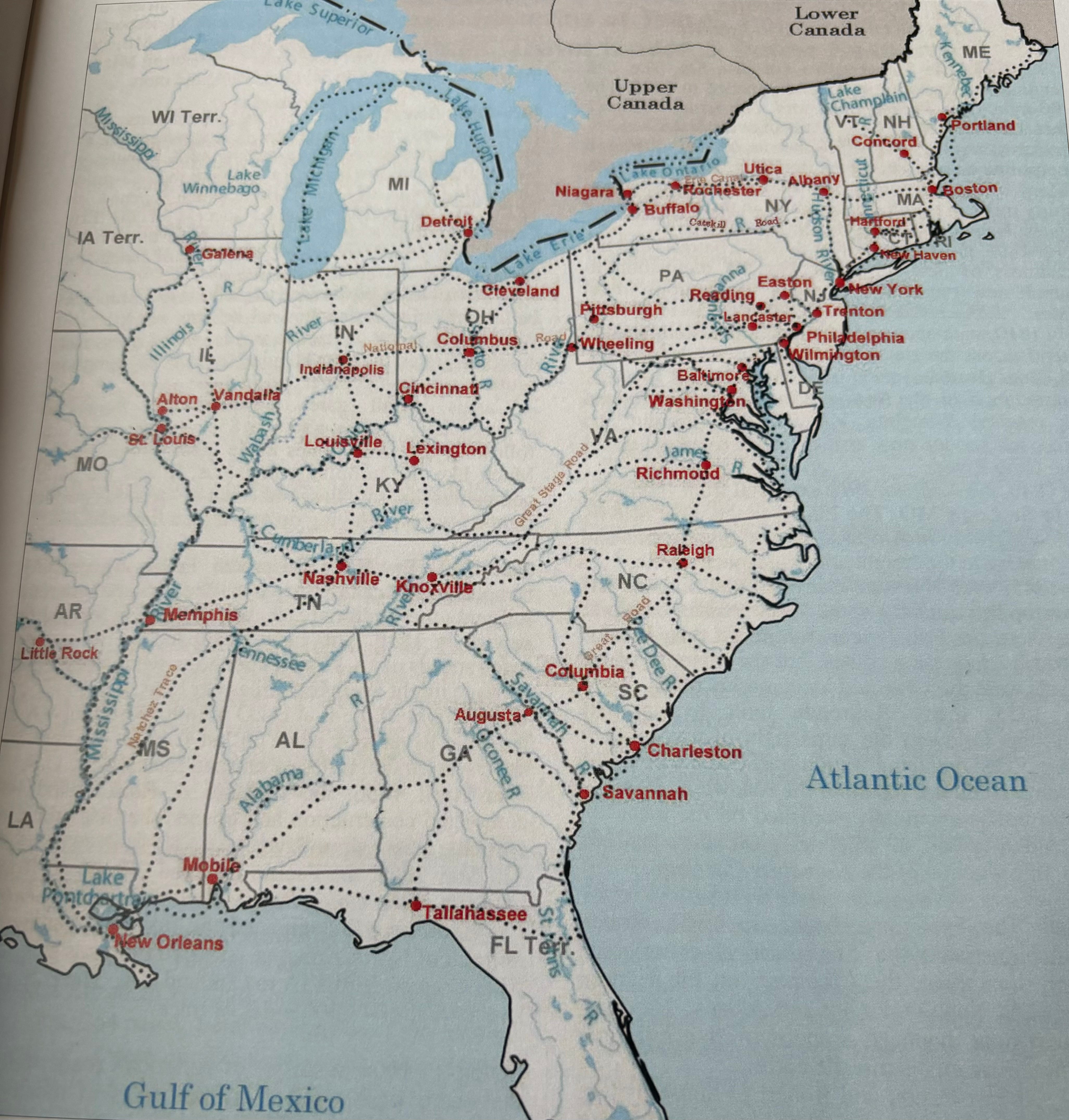

Baptist traveled south to get to St Mary’s through the southern tier of New York State into the northern tier of Pennsylvania. Wilhelm traveled north and west from Philadelphia. This would normally take several hours for us by car. However, it took them days by different…
Keep reading with a 7-day free trial
Subscribe to Rainey Mitchell’s Gallery to keep reading this post and get 7 days of free access to the full post archives.